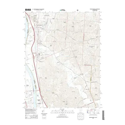
2013 Map of Wheelersburg
USGS Topo · Published 2013About this map
Wheelersburg and its surrounding communities are documented here as they appeared in 2013, bounded by the Ohio River and the expansive ridges of the Wayne National Forest. This survey illustrates a landscape of clustered river-valley settlements such as Franklin Furnace, Sciotodale, and Garden City, many of which grew along the historic Gallia Pike Rd. The terrain is deeply carved by countless named hollows, including Smithline Hollow, Riepenhoff Hollow, and Franklin Hollow, reflecting the region's complex topography.
Find a feature on this map
130 named features on this map. Tap any name to fly to it.
Don’t see what you’re looking for? This feature index may not catch every label — zoom into the map to look around manually.
Map Details
Editions of this 2013 Wheelersburg Map
This is the sole edition of this map. No revisions or reprints were ever made.
Other maps of this area

1898 · Ironton
USGS Topo · 1:62,500

1900 · Ironton
USGS Topo · 1:62,500

1911 · Sciotoville
USGS Topo · 1:62,500

1912 · Oak Hill
USGS Topo · 1:62,500

1913 · Sciotoville
USGS Topo · 1:62,500

1926 · Greenup
USGS Topo · 1:48,000

1930 · Greenup
USGS Topo · 1:62,500
1953 · Load
USGS Topo · 1:24,000

1953 · Greenup
USGS Topo · 1:24,000
1953 · Portsmouth
USGS Topo · 1:24,000