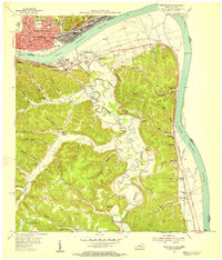
1953 Map of Portsmouth
USGS Topo · Published 1955About this map
The Ohio River forms the industrial and geographic spine of this mid-century portrait, where the urban density of Portsmouth and New Boston meets the rural ridges of northern Kentucky. The landscape is defined by the massive rail corridors of the B & O and the Chesapeake and Ohio, which parallel the river and connect settlements like South Shore and Fullerton. Beyond the river flats, the topography rises sharply into Beauty Ridge, where life centered around small valley communities such as Maloneton and Sunshine. The complex meanders of Tygarts Creek create a distinct pocket of geography featuring Horseshoe Lake, while the presence of the Howland Lookout Tower and various rural institutions like Plum Fork Sch and New Bethlehem Ch reflect a dispersed backcountry society. Evidence of local industry appears in the form of a inactive clay pit and the expansive rail yards that served the region's commerce.
Find a feature on this map
84 named features on this map. Tap any name to fly to it.
Don’t see what you’re looking for? This feature index may not catch every label — zoom into the map to look around manually.
Map Details
Editions of this 1953 Portsmouth Map
2 editions found
Other maps of this area

1911 · Sciotoville
USGS Topo · 1:62,500

1913 · Sciotoville
USGS Topo · 1:62,500

1915 · Garrison
USGS Topo · 1:62,500

1915 · Otway
USGS Topo · 1:62,500

1917 · Otway
USGS Topo · 1:62,500

1918 · Garrison
USGS Topo · 1:62,500

1926 · Greenup
USGS Topo · 1:48,000

1930 · Greenup
USGS Topo · 1:62,500

1949 · Friendship
USGS Topo · 1:24,000

1949 · Brushart
USGS Topo · 1:24,000