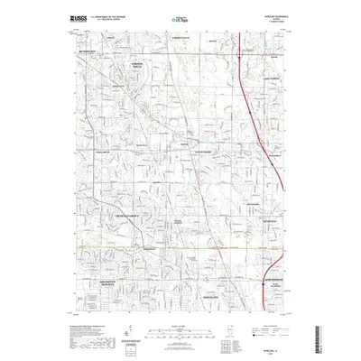
2021 Map of Wheeling
USGS Topo · Published 2021About this map
The Des Plaines River and the N Br Chicago River anchor this highly developed landscape along the boundary of Lake Co and Cook Co. The transition between the sprawling residential communities of Buffalo Grove, Vernon Hills, and Wheeling is defined by a dense network of major thoroughfares, including Lake-Cook Rd and Townline Rd. This modern survey reveals how historic settlements like Half Day and Aptakisic have been integrated into the suburban fabric of the Chicago metropolitan area.
Find a feature on this map
72 named features on this map. Tap any name to fly to it.
Don’t see what you’re looking for? This feature index may not catch every label — zoom into the map to look around manually.
Map Details
Editions of this 2021 Wheeling Map
This is the sole edition of this map. No revisions or reprints were ever made.
Other maps of this area

1900 · Highwood
USGS Topo · 1:62,500

1906 · Waukegan
USGS Topo · 1:62,500

1908 · Waukegan
USGS Topo · 1:62,500

1920 · Grays Lake
USGS Topo · 1:62,500

1923 · Grays Lake
USGS Topo · 1:62,500

1923 · Barrington
USGS Topo · 1:62,500

1927 · Arlington Heights
USGS Topo · 1:24,000

1928 · Wheeling
USGS Topo · 1:24,000

1928 · Highland Park
USGS Topo · 1:24,000

1929 · Park Ridge
USGS Topo · 1:24,000