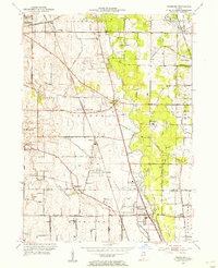
1953 Map of Wheeling
USGS Topo · Published 1955About this map
The Des Plaines River corridor serves as the central spine of this mid-century portrait, capturing a transitional period as rural agricultural lands began meeting the suburban reach of the Chicago area. The landscape is dotted with legacy settlements like Halfday, Wheeling, and Prairie View, alongside specialized landmarks such as Maremont Speedway and the Chicagoland Airport. The presence of several country clubs, including Twin Orchard Country Club and Thorngate Country Club, indicates the region's shift toward recreation and residential development.
Find a feature on this map
70 named features on this map. Tap any name to fly to it.
Don’t see what you’re looking for? This feature index may not catch every label — zoom into the map to look around manually.
Map Details
Editions of this 1953 Wheeling Map
This is the sole edition of this map. No revisions or reprints were ever made.
Other maps of this area

1900 · Highwood
USGS Topo · 1:62,500

1906 · Waukegan
USGS Topo · 1:62,500

1908 · Waukegan
USGS Topo · 1:62,500

1920 · Grays Lake
USGS Topo · 1:62,500

1923 · Grays Lake
USGS Topo · 1:62,500

1923 · Barrington
USGS Topo · 1:62,500

1927 · Arlington Heights
USGS Topo · 1:24,000

1928 · Wheeling
USGS Topo · 1:24,000

1928 · Highland Park
USGS Topo · 1:24,000

1929 · Park Ridge
USGS Topo · 1:24,000