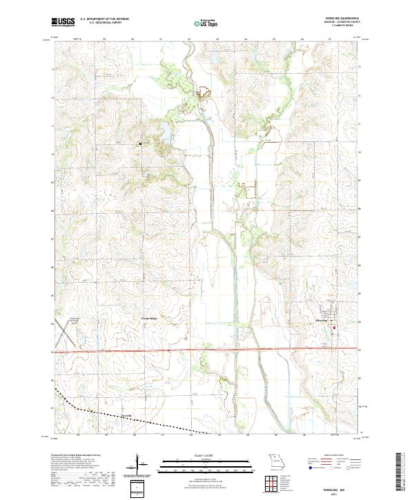
2021 Map of Wheeling
USGS Topo · Published 2021About this map
Wheeling serves as the primary hub of this north-central Missouri landscape, situated near the western edge of the Grand River basin. The terrain is defined by the gentle elevation of Cream Ridge and the meandering path of Medicine Creek, which flows south alongside a network of local roads including State HWY KK. To the west, the Chillicothe Municipal Airport provides a modern aviation anchor, while the small settlement of Norville sits further south. The map documents an agricultural grid interrupted by the dendritic patterns of several waterways like Muddy Cr and Sapp Br, showing how the land has been managed for farming and local transit.
Find a feature on this map
45 named features on this map. Tap any name to fly to it.
Don’t see what you’re looking for? This feature index may not catch every label — zoom into the map to look around manually.
Map Details
Editions of this 2021 Wheeling Map
This is the sole edition of this map. No revisions or reprints were ever made.
Other maps of this area

1921 · Chillicothe
USGS Topo · 1:62,500

1923 · Chillicothe
USGS Topo · 1:62,500

1924 · Dawn
USGS Topo · 1:62,500

1924 · Chula
USGS Topo · 1:62,500

1924 · Hale
USGS Topo · 1:62,500

1947 · Chula
USGS Topo · 1:62,500

1951 · Utica
USGS Topo · 1:62,500

1951 · Hale
USGS Topo · 1:62,500

1953 · Moberly
USGS Topo · 1:250,000

1954 · Moberly
USGS Topo · 1:250,000