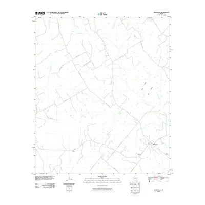
2010 Map of Wheelock
USGS Topo · Published 2010About this map
Wheelock stands as a focal point in this landscape of Robertson County, where local history is etched into the terrain through a network of family-named cemeteries and rural roads. The settlement is anchored by Wheelock Cemetery, Cavitt Cemetery, and the nearby Arnett Cemetery, providing a dense record for genealogical research in this corner of Texas. A short distance away, the map marks Red Hill, another point of early settlement connected by historical corridors like Henry Prairie Rd and Henry Prairie Church Rd. The landscape is defined by its many small waterways, including the winding paths of Brushy Creek, Copperas Creek, and Moss Spring Branch, which have long shaped the agricultural patterns of the region. The map also captures the route of E Osr, tracing a portion of the historical Old San Antonio Road along the southern edge of the survey.
Find a feature on this map
46 named features on this map. Tap any name to fly to it.
Don’t see what you’re looking for? This feature index may not catch every label — zoom into the map to look around manually.
Map Details
Editions of this 2010 Wheelock Map
This is the sole edition of this map. No revisions or reprints were ever made.
Other maps of this area

1925 · Marquez No. 4
USGS Topo · 1:48,000

1927 · Marquez
USGS Topo · 1:62,500

1930 · Marquez
USGS Topo · 1:62,500

1954 · Waco
USGS Topo · 1:250,000

1954 · Austin
USGS Topo · 1:250,000

1955 · Waco
USGS Topo · 1:250,000

1961 · Hearne North
USGS Topo · 1:24,000

1961 · Hearne South
USGS Topo · 1:24,000

1962 · Edge
USGS Topo · 1:24,000

1962 · Wheelock
USGS Topo · 1:24,000