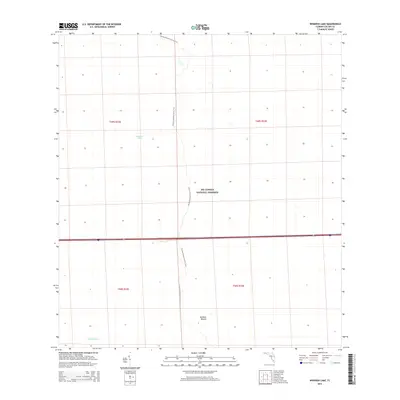
2015 Map of Whidden Lake
USGS Topo · Published 2015About this map
Big Cypress National Preserve encompasses the majority of this landscape, reflecting a protected subtropical wilderness in Collier County. The map details the central corridor of the Florida National Scenic Trail, which winds north-to-south through a landscape defined by seasonal water flow and slight elevation changes. Significant hydrographic features include Whidden Lake and the wetlands of Mullet Slough, while Bamboo Mound provides a rare point of named topographical interest in the southern portion of the quadrangle. The lack of established roads and settlements highlights the preserved nature of this interior swamp and prairie system during the early 21st century.
Find a feature on this map
9 named features on this map. Tap any name to fly to it.
Don’t see what you’re looking for? This feature index may not catch every label — zoom into the map to look around manually.
Map Details
Editions of this 2015 Whidden Lake Map
This is the sole edition of this map. No revisions or reprints were ever made.
Other maps of this area

1956 · West Palm Beach
USGS Topo · 1:250,000

1957 · West Palm Beach
USGS Topo · 1:250,000

1958 · West Palm Beach
USGS Topo · 1:250,000

1974 · Everglades 2 SW
USGS Topo · 1:24,000

1974 · Immokalee 4 NW
USGS Topo · 1:24,000

1974 · Immokalee 1 SW
USGS Topo · 1:24,000

1974 · Immokalee 1 SE
USGS Topo · 1:24,000

1974 · Immokalee 4 SW
USGS Topo · 1:24,000

1974 · Everglades 3 SW
USGS Topo · 1:24,000

1974 · Immokalee 4 NE
USGS Topo · 1:24,000