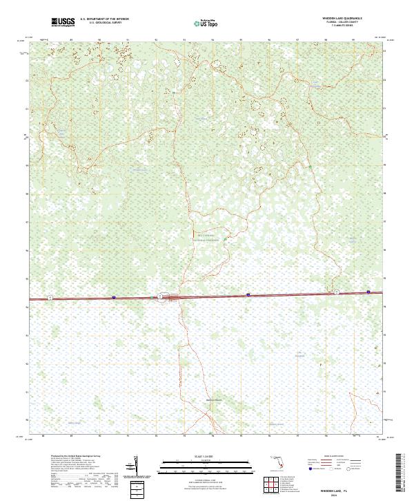
2024 Map of Whidden Lake
USGS Topo · Published 2024About this map
Big Cypress National Preserve defines the character of this Collier County landscape, where the interior wetlands of the Everglades dominate the terrain. The sheet highlights a complex network of sloughs and strands, including Kissimmee Billy Strand, Dark Strand, and Cow Bell Strand, which are critical natural conduits for water moving through the cypress swamps. Small topographic elevations like Bamboo Mound provide rare dry ground amidst the surrounding inundation, while Whidden Lake serves as a primary water feature in this wilderness area.
Find a feature on this map
16 named features on this map. Tap any name to fly to it.
Don’t see what you’re looking for? This feature index may not catch every label — zoom into the map to look around manually.
Map Details
Editions of this 2024 Whidden Lake Map
This is the sole edition of this map. No revisions or reprints were ever made.
Other maps of this area

1956 · West Palm Beach
USGS Topo · 1:250,000

1957 · West Palm Beach
USGS Topo · 1:250,000

1958 · West Palm Beach
USGS Topo · 1:250,000

1974 · Everglades 2 SW
USGS Topo · 1:24,000

1974 · Immokalee 4 NW
USGS Topo · 1:24,000

1974 · Immokalee 1 SW
USGS Topo · 1:24,000

1974 · Immokalee 1 SE
USGS Topo · 1:24,000
1974 · Immokalee 4 SW
USGS Topo · 1:24,000

1974 · Everglades 3 SW
USGS Topo · 1:24,000

1974 · Immokalee 4 NE
USGS Topo · 1:24,000