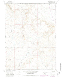
1963 Map of Whiskey Buttes
USGS Topo · Published 1981About this map
Whiskey Basin and the prominent Whiskey Buttes dominate this high-desert landscape in the southwest corner of Wyoming. The terrain is defined by a network of drainage systems, including the Sevenmile Gulch and South Fork, which carve through the land before reaching the eastern boundary. Part of the Seedskadee National Wildlife Refuge is visible along the eastern edge, highlighting the area's conservation significance. The map illustrates a remote environment primarily accessed by a network of Jeep Trails and unnamed roads, reflecting the character of Sweetwater County before extensive modern development. Traces of seasonal water flow are evident in features like West Otterson Wash and Yellow Point Fork, while Shute Creek cuts across the northern section of the survey.
Find a feature on this map
10 named features on this map. Tap any name to fly to it.
Don’t see what you’re looking for? This feature index may not catch every label — zoom into the map to look around manually.
Map Details
Editions of this 1963 Whiskey Buttes Map
2 editions found
Other maps of this area

1954 · Ogden
USGS Topo · 1:250,000

1954 · Rock Springs
USGS Topo · 1:250,000

1958 · Ogden
USGS Topo · 1:250,000

1958 · Rock Springs
USGS Topo · 1:250,000

1960 · Ogden
USGS Topo · 1:250,000

1961 · Blue Point
USGS Topo · 1:24,000

1961 · Sevenmile Gulch
USGS Topo · 1:24,000

1962 · Rock Springs
USGS Topo · 1:250,000
1963 · Whiskey Buttes
USGS Topo · 1:24,000
1963 · Mc Cullen Bluff
USGS Topo · 1:24,000