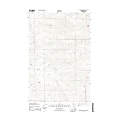
2017 Map of Whiskey Dick Mountain
USGS Topo · Published 2017About this map
Whiskey Dick Mountain anchors this Kittitas County landscape, a complex drainage system defined by deep canyons and numerous named water sources. The map reveals a vital network of springs, such as Government Springs, Spike Spring, and Wild Horse Spring, which likely served as critical water points in this arid upland. These sources feed a labyrinth of seasonal and perennial streams including Skookumchuck Cr and the Whiskey Dick Cr. The terrain is deeply incised by Black Rock Canyon and Patte Canyon, illustrating the erosive power of the local watershed. Beyond the natural features, the presence of Hilltop Ln and established section boundaries indicate the intersection of public land management and rural access in the early 21st century.
Find a feature on this map
38 named features on this map. Tap any name to fly to it.
Don’t see what you’re looking for? This feature index may not catch every label — zoom into the map to look around manually.
Map Details
Editions of this 2017 Whiskey Dick Mountain Map
This is the sole edition of this map. No revisions or reprints were ever made.
Other maps of this area

1920 · Colockum Pass
USGS Topo · 1:125,000

1922 · Colockum Pass
USGS Topo · 1:125,000

1938 · Badger Pocket
USGS Topo · 1:48,000

1939 · Boylston
USGS Topo · 1:48,000

1943 · Boylston
USGS Topo · 1:62,500

1943 · Badger Pocket
USGS Topo · 1:62,500

1950 · Yakima
USGS Topo · 1:250,000

1953 · Ginkgo
USGS Topo · 1:24,000
1953 · East Kittitas
USGS Topo · 1:24,000
1953 · Boylston
USGS Topo · 1:24,000