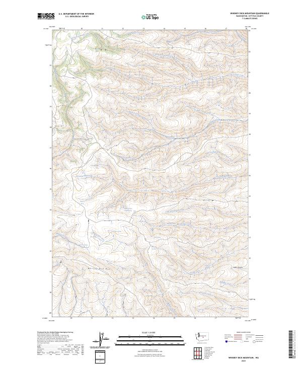
2023 Map of Whiskey Dick Mountain
USGS Topo · Published 2023About this map
Whiskey Dick Mtn dominates this Kittitas County landscape, a terrain defined by high ridges and a dense network of seasonal drainages and springs. The northeastern portion of the map is preserved as part of the Colockum Game Range, highlighting the area's importance for wildlife and habitat conservation. Hydrological features are the primary landmarks here, with named sources such as Government Springs, Wild Horse Spring, and Basalt Spring providing critical water points in an otherwise arid environment. The complex drainage system includes the winding paths of Quilomene Creek and Skookumchuck Creek, which carve deep through the township and range lines. Local history and geography are preserved through distinctive names like Whiskey Jim Creek and the remote Patte Canyon, reflecting a landscape primarily used for recreation, grazing, and resource management.
Find a feature on this map
36 named features on this map. Tap any name to fly to it.
Don’t see what you’re looking for? This feature index may not catch every label — zoom into the map to look around manually.
Map Details
Editions of this 2023 Whiskey Dick Mountain Map
This is the sole edition of this map. No revisions or reprints were ever made.
Other maps of this area

1920 · Colockum Pass
USGS Topo · 1:125,000

1922 · Colockum Pass
USGS Topo · 1:125,000

1938 · Badger Pocket
USGS Topo · 1:48,000

1939 · Boylston
USGS Topo · 1:48,000

1943 · Boylston
USGS Topo · 1:62,500

1943 · Badger Pocket
USGS Topo · 1:62,500

1950 · Yakima
USGS Topo · 1:250,000

1953 · Ginkgo
USGS Topo · 1:24,000
1953 · East Kittitas
USGS Topo · 1:24,000
1953 · Boylston
USGS Topo · 1:24,000