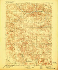
1899 Map of Whistle Creek
USGS Topo · Published 1917About this map
The Niobrara River carves across the northern reaches of this High Plains landscape, anchoring a network of vital water sources in an otherwise arid expanse. Surveyed in the mid-1890s, the terrain is defined by its drainages, including Whistle Creek and Snake Creek, which supported early ranching operations. The settlement of Agate and the presence of Corbin's Ranch and 33 Ranch reflect the era’s livestock-driven economy, where access to water was the primary driver of habitation.
Find a feature on this map
21 named features on this map. Tap any name to fly to it.
Don’t see what you’re looking for? This feature index may not catch every label — zoom into the map to look around manually.
Map Details
Editions of this 1899 Whistle Creek Map
4 editions found
Other maps of this area

1896 · Patrick
USGS Topo · 1:125,000

1898 · Scotts Bluff
USGS Topo · 1:125,000

1898 · Camp Clarke
USGS Topo · 1:125,000

1899 · Goshen Hole
USGS Topo · 1:125,000

1899 · Whistle Creek
USGS Topo · 1:125,000

1951 · Marsland
USGS Topo · 1:62,500

1951 · Kilpatrick Lake
USGS Topo · 1:62,500

1954 · Scottsbluff
USGS Topo · 1:250,000

1954 · Torrington
USGS Topo · 1:250,000

1954 · Cheyenne
USGS Topo · 1:250,000