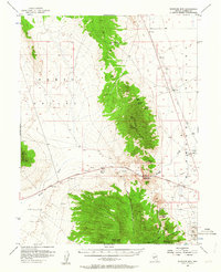
1956 Map of Whistler Mtn
USGS Topo · Published 1964About this map
Whistler Mtn dominates the central landscape of this mid-century Nevada survey, serving as a high-altitude divide between the vast basins of Kobe Valley to the west and Diamond Valley to the east. The terrain reflects the rugged mining and ranching economy of the era, with the southern Mahogany Hills revealing a concentration of industrial activity. Prospectors and local historians can trace the locations of the Silver Lick Mine, Wales Mine, Price & Davis Mine, and Chance Mine tucked into the canyons near Signal Peak.
Find a feature on this map
37 named features on this map. Tap any name to fly to it.
Don’t see what you’re looking for? This feature index may not catch every label — zoom into the map to look around manually.
Map Details
Editions of this 1956 Whistler Mtn Map
3 editions found

Other maps of this area

1926 · Roberts Mountains
USGS Topo · 1:250,000

1929 · Roberts Mountains
USGS Topo · 1:250,000

1949 · Garden Valley
USGS Topo · 1:62,500

1949 · Roberts Creek Mtn
USGS Topo · 1:62,500

1951 · Roberts Creek Mtn
USGS Topo · 1:62,500

1951 · Garden Valley
USGS Topo · 1:62,500

1953 · Pinto Summit
USGS Topo · 1:62,500

1953 · Eureka
USGS Topo · 1:62,500

1955 · Millett
USGS Topo · 1:250,000

1956 · Bellevue Peak
USGS Topo · 1:62,500