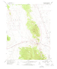
1956 Map of Whistler Mtn
USGS Topo · Published 1978About this map
The Mahogany Hills and Whistler Mtn dominate this 1956 landscape, forming a high-altitude barrier between Kobeh Valley and Diamond Valley. In the southeastern corner, the mining history of the Mountain Boy Range is evident through several named workings, including the Silver Lick Mine and the Price & Davis Mine. The transport network shows a clear transition between eras, featuring the Lincoln Highway cutting through the narrow pass at Devils Gate, while a lingering Railroad Grade traces the eastern edge of the mountains. This survey captures a remote ranching and mining environment where water sources like Stinking Spring and Hash Spring were vital landmarks for navigation and survival in the high desert of central Nevada.
Find a feature on this map
34 named features on this map. Tap any name to fly to it.
Don’t see what you’re looking for? This feature index may not catch every label — zoom into the map to look around manually.
Map Details
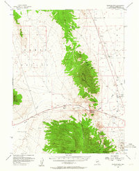
Editions of this 1956 Whistler Mtn Map
3 editions found

Other maps of this area

1926 · Roberts Mountains
USGS Topo · 1:250,000

1929 · Roberts Mountains
USGS Topo · 1:250,000

1949 · Garden Valley
USGS Topo · 1:62,500

1949 · Roberts Creek Mtn
USGS Topo · 1:62,500

1951 · Roberts Creek Mtn
USGS Topo · 1:62,500

1951 · Garden Valley
USGS Topo · 1:62,500

1953 · Pinto Summit
USGS Topo · 1:62,500

1953 · Eureka
USGS Topo · 1:62,500

1955 · Millett
USGS Topo · 1:250,000

1956 · Bellevue Peak
USGS Topo · 1:62,500