
1967 Map of White Bear Lake East
USGS Topo · Published 1969About this map
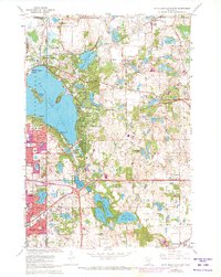
White Bear Lake dominates the western half of this 1967 revision, its deep contours and shoreline settlements like White Bear Beach and Dellwood reflecting the region's development as a primary residential and recreational hub. The Northern Pacific railroad tracks bisect the landscape, connecting established communities such as Mahtomedi, Willernie, and Birchwood with the rail corridor at Duluth Junction. The map captures a high density of civic infrastructure from the mid-century era, including numerous educational facilities like Sunrise Park Sch and North High Sch, alongside local landmarks such as Benson Airport and Northport Airport. To the south, the expansion of North St Paul is evident, while the surrounding townships of Lincoln Twp, Grant, and Oakdale are dotted with family-named waters like Olson Lake and Lake Jane. Genealogists will find particular value in the clearly marked Evergreen, Lakeview, and St Marys cemeteries.
Find a feature on this map
58 named features on this map. Tap any name to fly to it.
Don’t see what you’re looking for? This feature index may not catch every label — zoom into the map to look around manually.
Map Details
Editions of this 1967 White Bear Lake East Map
5 editions found
Other maps of this area

1896 · St. Paul
USGS Topo · 1:62,500

1902 · White Bear
USGS Topo · 1:62,500

1946 · Hudson
USGS Topo · 1:62,500

1948 · Stillwater
USGS Topo · 1:62,500

1949 · Hudson
USGS Topo · 1:62,500

1949 · Stillwater
USGS Topo · 1:62,500

1949 · Lake Elmo
USGS Topo · 1:24,000

1949 · Hudson
USGS Topo · 1:24,000

1950 · Lake Elmo
USGS Topo · 1:24,000

1950 · Hudson
USGS Topo · 1:24,000