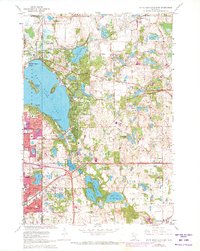
1967 Map of White Bear Lake East
USGS Topo · Published 1973About this map
White Bear Lake and its eastern shores dominate this landscape, revealing a transition from lakeside recreation to suburban expansion in the late 1960s. The dense settlement patterns of Mahtomedi, Dellwood, and Willernie hug the shoreline, while newer developments like Pine Springs and Maplewood push eastward. The rail corridor of the Burlington Northern cuts through the region, connecting historical transit points like Duluth Junction to the growing residential areas. Local institutional life is well-documented through numerous educational and spiritual landmarks, including Sunrise Park Sch, St Marys Ch, and the Lakeview Cem. The map provides a high-resolution look at the complex hydrography of the area, featuring a chain of water bodies such as Lake De Montreville, Lake Olson, and Lake Jane that define the character of Oakdale.
Find a feature on this map
57 named features on this map. Tap any name to fly to it.
Don’t see what you’re looking for? This feature index may not catch every label — zoom into the map to look around manually.
Map Details
Editions of this 1967 White Bear Lake East Map
5 editions found

Other maps of this area

1896 · St. Paul
USGS Topo · 1:62,500

1902 · White Bear
USGS Topo · 1:62,500

1946 · Hudson
USGS Topo · 1:62,500

1948 · Stillwater
USGS Topo · 1:62,500

1949 · Hudson
USGS Topo · 1:62,500

1949 · Stillwater
USGS Topo · 1:62,500

1949 · Lake Elmo
USGS Topo · 1:24,000

1949 · Hudson
USGS Topo · 1:24,000

1950 · Lake Elmo
USGS Topo · 1:24,000

1950 · Hudson
USGS Topo · 1:24,000