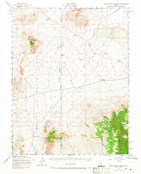
1952 Map of White Blotch Springs
USGS Topo · Published 1966About this map
White Blotch Springs and the surrounding desert basin of Spring Valley dominate this mid-century topographic study of the Nevada high desert. Established within the restrictive boundaries of the Nellis Air Force Range, the landscape is defined by vast alluvial fans and the imposing peaks of the Groom Range to the southeast. The map details a strictly utilitarian infrastructure designed for survival and military operations in an arid environment, including a prominent Aqueduct and isolated Water Tanks. The rugged terrain of the Air Force Range is marked by numerous survey benchmarks and scattered water sources, reflecting the logistical challenges of maintaining a presence in this remote interior of the Great Basin. This document captures the intersection of military land use and natural hydrology along the Nye and Lincoln County line during a period of significant regional expansion.
Find a feature on this map
11 named features on this map. Tap any name to fly to it.
Don’t see what you’re looking for? This feature index may not catch every label — zoom into the map to look around manually.
Map Details
Editions of this 1952 White Blotch Springs Map
3 editions found
Other maps of this area

1908 · Kawich
USGS Topo · 1:250,000

1942 · Emigrant Valley
USGS Topo · 1:125,000

1942 · Reveille Peak
USGS Topo · 1:125,000

1942 · Wheelbarrow Peak
USGS Topo · 1:125,000

1942 · Penoyer Valley
USGS Topo · 1:125,000

1952 · White Blotch Springs
USGS Topo · 1:62,500

1952 · Reveille Peak
USGS Topo · 1:62,500

1952 · Wheelbarrow Peak
USGS Topo · 1:62,500

1952 · Belted Peak
USGS Topo · 1:62,500

1952 · Groom Mine
USGS Topo · 1:62,500