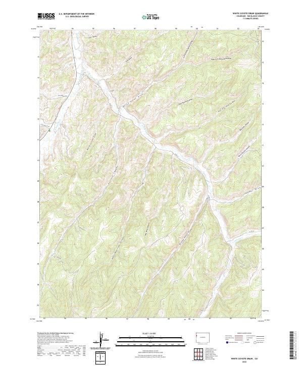
2022 Map of White Coyote Draw
USGS Topo · Published 2022About this map
Douglas Cr and its tributaries define the intricate drainage network of this high-country landscape in Rio Blanco County. The map details a complex system of deep-cut draws and canyons, including the central White Coyote Draw and the expansive Pollock Canyon. These geographical features influenced early transportation routes and land use, as seen by the path of Co RD 27 and Co RD 128 navigating the uneven terrain between t2s r101w and t3s r100w.
Find a feature on this map
29 named features on this map. Tap any name to fly to it.
Don’t see what you’re looking for? This feature index may not catch every label — zoom into the map to look around manually.
Map Details
Editions of this 2022 White Coyote Draw Map
This is the sole edition of this map. No revisions or reprints were ever made.
Other maps of this area

1956 · Grand Junction
USGS Topo · 1:250,000

1959 · Grand Junction
USGS Topo · 1:250,000

1960 · Grand Junction
USGS Topo · 1:250,000

1962 · Grand Junction
USGS Topo · 1:250,000

1964 · Grand Junction
USGS Topo · 1:250,000

1964 · Brushy Point
USGS Topo · 1:24,000
1964 · Philadelphia Creek
USGS Topo · 1:24,000
1964 · Water Canyon
USGS Topo · 1:24,000

1964 · Black Cabin Gulch
USGS Topo · 1:24,000
1964 · White Coyote Draw
USGS Topo · 1:24,000