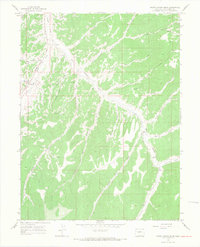
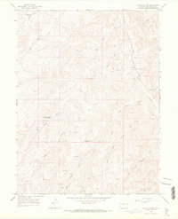
1964 Map of White Coyote Draw
USGS Topo · Published 1968About this map
Douglas Creek and its many winding tributaries define this high-altitude drainage system in Rio Blanco County during the mid-1960s. The landscape is characterized by a complex network of canyons and draws, including White Coyote Draw, Pollock Canyon, and Horse Pasture Canyon. Human presence is sparse but specific, marked by isolated outposts such as Brady Ranch and the Mitchel Place near the confluence with Cathedral Creek.
Find a feature on this map
32 named features on this map. Tap any name to fly to it.
Don’t see what you’re looking for? This feature index may not catch every label — zoom into the map to look around manually.
Map Details
Editions of this 1964 White Coyote Draw Map
3 editions found
Other maps of this area

1956 · Grand Junction
USGS Topo · 1:250,000

1959 · Grand Junction
USGS Topo · 1:250,000

1960 · Grand Junction
USGS Topo · 1:250,000

1962 · Grand Junction
USGS Topo · 1:250,000

1964 · Grand Junction
USGS Topo · 1:250,000

1964 · Brushy Point
USGS Topo · 1:24,000
1964 · Philadelphia Creek
USGS Topo · 1:24,000
1964 · Water Canyon
USGS Topo · 1:24,000

1964 · Black Cabin Gulch
USGS Topo · 1:24,000
1964 · Texas Mountain
USGS Topo · 1:24,000