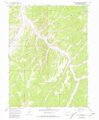
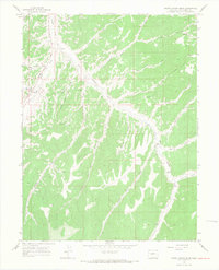
1964 Map of White Coyote Draw
USGS Topo · Published 1981About this map
Douglas Creek and its many seasonal tributaries carve a complex network through this high-plateau landscape in Rio Blanco County. Surveyed in the mid-1960s, the terrain is defined by deep draws and steep ridges like Rocky Point and Brushy Point. While the area remains largely undeveloped, human activity is evident through specific cultural markers, including ancient Pictographs found near the creek and industrial additions such as a north-south pipeline and several drill holes. Local ranching history is anchored by the Brady Ranch and the Mitchel Place, which occupy more accessible ground near the watercourses. The drainage patterns of White Coyote Draw, Cathedral Creek, and Pollock Canyon dictate the natural travel corridors through this high country, providing a clear view of the land as it functioned before later twentieth-century shifts in land use.
Find a feature on this map
34 named features on this map. Tap any name to fly to it.
Don’t see what you’re looking for? This feature index may not catch every label — zoom into the map to look around manually.
Map Details
Editions of this 1964 White Coyote Draw Map
3 editions found
Other maps of this area

1956 · Grand Junction
USGS Topo · 1:250,000

1959 · Grand Junction
USGS Topo · 1:250,000

1960 · Grand Junction
USGS Topo · 1:250,000

1962 · Grand Junction
USGS Topo · 1:250,000

1964 · Grand Junction
USGS Topo · 1:250,000

1964 · Brushy Point
USGS Topo · 1:24,000
1964 · Philadelphia Creek
USGS Topo · 1:24,000
1964 · Water Canyon
USGS Topo · 1:24,000

1964 · Black Cabin Gulch
USGS Topo · 1:24,000
1964 · White Coyote Draw
USGS Topo · 1:24,000