
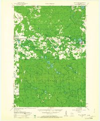
1952 Map of White Lake
USGS Topo · Published 1955About this map
The Menominee Indian Reservation and Nicolet National Forest dominate this mid-century portrait of northern Wisconsin. The landscape is defined by the Wolf River and a dense network of timberlands, where life is organized around small settlements like Elton, Polar, and the village of White Lake. This area was deeply tied to the Chicago and North Western railroad, which provided the vital connection for moving timber and goods through the woods.
Find a feature on this map
72 named features on this map. Tap any name to fly to it.
Don’t see what you’re looking for? This feature index may not catch every label — zoom into the map to look around manually.
Map Details
Editions of this 1952 White Lake Map
2 editions found
Other maps of this area

1942 · Elcho
USGS Topo · 1:48,000

1942 · Wabeno
USGS Topo · 1:48,000

1942 · Pearson
USGS Topo · 1:48,000

1950 · Wabeno
USGS Topo · 1:48,000

1950 · Elcho
USGS Topo · 1:48,000

1950 · Lily
USGS Topo · 1:48,000

1951 · Wabeno
USGS Topo · 1:48,000

1952 · Antigo
USGS Topo · 1:48,000

1952 · Langlade
USGS Topo · 1:48,000

1954 · Wittenberg
USGS Topo · 1:48,000