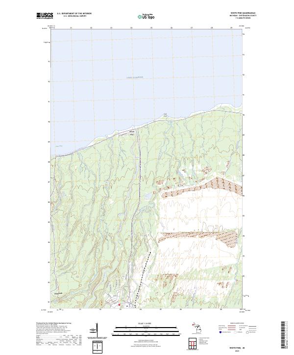
2023 Map of White Pine
USGS Topo · Published 2023About this map
Silver City stands as a focal point of this coastal landscape along the southern shore of Lake Superior. The terrain is defined by a dense network of waterways draining north into Union Bay, including the Big Iron River, Mineral River, and Little Iron River. The dramatic elevation changes in Ontonagon County are evidenced by a sequence of waterfalls such as Bonanza Falls, Pewabeck Falls, and the Little Union Gorge Falls. To the south, the namesake settlement of Nonesuch near Nonesuch Falls recalls the copper mining history of the Porcupine Mountains region. Modern infrastructure like the 107th Engineers Memorial Hwy and local roads like Seward Ave provide access to this transition from the shoreline at Gull Point to the elevated interior woodlands.
Find a feature on this map
41 named features on this map. Tap any name to fly to it.
Don’t see what you’re looking for? This feature index may not catch every label — zoom into the map to look around manually.
Map Details
Editions of this 2023 White Pine Map
This is the sole edition of this map. No revisions or reprints were ever made.
Other maps of this area

1949 · Matchwood NW
USGS Topo · 1:24,000

1949 · White Pine
USGS Topo · 1:24,000

1949 · Bergland NE
USGS Topo · 1:24,000

1955 · Ontonagon
USGS Topo · 1:62,500

1956 · Bergland NE
USGS Topo · 1:24,000

1956 · Bergland
USGS Topo · 1:62,500

1956 · White Pine
USGS Topo · 1:24,000

1956 · Matchwood NW
USGS Topo · 1:24,000

1956 · White Pine
USGS Topo · 1:62,500

1956 · Matchwood
USGS Topo · 1:62,500