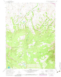
1958 Map of White Rock Canyon
USGS Topo · Published 1983About this map
Wick Brothers Ranch and its nearby Wick Brothers Sheep Camp anchor this mid-century look at the high-elevation pastures and timberlands within the Medicine Bow National Forest. The landscape is dominated by the drainages of Wagonhound Creek and the Medicine Bow River, where natural features like White Rock Canyon and Conical Peak rise above named meadows such as Racehorse Park and Stanley Park.
Find a feature on this map
28 named features on this map. Tap any name to fly to it.
Don’t see what you’re looking for? This feature index may not catch every label — zoom into the map to look around manually.
Map Details
Editions of this 1958 White Rock Canyon Map
4 editions found
Other maps of this area

1906 · Medicine Bow
USGS Topo · 1:125,000

1908 · Medicine Bow
USGS Topo · 1:125,000

1954 · Rawlins
USGS Topo · 1:250,000

1955 · Elk Mountain
USGS Topo · 1:24,000

1955 · Elk Mountain SW
USGS Topo · 1:24,000

1958 · Rawlins
USGS Topo · 1:250,000

1958 · White Rock Canyon
USGS Topo · 1:24,000

1958 · Arlington
USGS Topo · 1:24,000

1958 · Mc Fadden
USGS Topo · 1:24,000

1958 · T L Ranch
USGS Topo · 1:24,000