
2012 Map of White Springs West
USGS Topo · Published 2012About this map
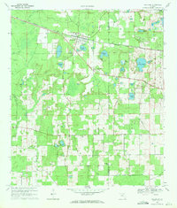
The Suwannee River carves a winding path through this North Florida landscape, providing a natural boundary for the historic community of White Springs. This 2012 survey captures the region's transition from small riverfront settlements to a more modern infrastructure, marked by the extensive intersection of interstate and local routes near Pouchers Corner. Genealogy researchers will find several significant burial grounds, including the Swift Creek Cem near the northern boundary and Godbolt Cem to the south. Distinctive landmarks like the Bullock Lookout Tower and the J Graham Black-Joseph W McAlpin Bridge highlight the area's civil engineering and forestry history. Named water features such as Louisa Spring and Tiger Br are scattered across the terrain, reflecting the swampy, spring-fed character of the Hamilton County environment.
Find a feature on this map
116 named features on this map. Tap any name to fly to it.
Don’t see what you’re looking for? This feature index may not catch every label — zoom into the map to look around manually.
Map Details
Editions of this 2012 White Springs West Map
This is the sole edition of this map. No revisions or reprints were ever made.
Other maps of this area

1954 · Valdosta
USGS Topo · 1:250,000

1958 · Valdosta
USGS Topo · 1:250,000

1959 · Valdosta
USGS Topo · 1:250,000

1961 · Live Oak East
USGS Topo · 1:24,000

1961 · Hillcoat
USGS Topo · 1:24,000

1961 · White Springs East
USGS Topo · 1:24,000

1961 · White Springs West
USGS Topo · 1:24,000

1962 · Genoa
USGS Topo · 1:24,000

1963 · Lake City West
USGS Topo · 1:24,000
1969 · Wellborn
USGS Topo · 1:24,000