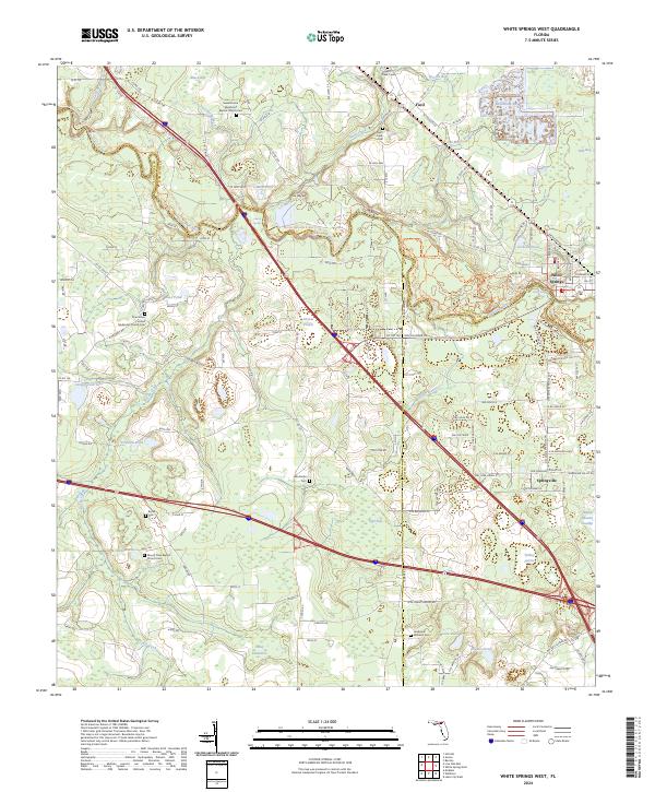
2024 Map of White Springs West
USGS Topo · Published 2024About this map
The Suwannee River carves a winding path through the northern Florida landscape, serving as the primary geographic focal point where White Springs and Springville are established. This 2024 map documents a region deeply rooted in communal history, evidenced by the numerous spiritual and memorial sites such as the Sweet Home Missionary Baptist Church Cem and Mount Olive Baptist Church Cem. The area near White Sulphur Spring and the Stephen Foster Folk Culture Center State Park highlights the local significance of the river's spring-fed ecosystem. Beyond the river banks, the terrain is defined by a series of low-lying wetlands and named hammocks, including Tiger Bay, Black Bay, and Caney Hammock. These features, alongside the network of county roads like Co RD 137, reveal a rural settlement pattern that follows the natural rises above the swampy bottomlands.
Find a feature on this map
148 named features on this map. Tap any name to fly to it.
Don’t see what you’re looking for? This feature index may not catch every label — zoom into the map to look around manually.
Map Details
Editions of this 2024 White Springs West Map
This is the sole edition of this map. No revisions or reprints were ever made.
Other maps of this area

1954 · Valdosta
USGS Topo · 1:250,000

1958 · Valdosta
USGS Topo · 1:250,000

1959 · Valdosta
USGS Topo · 1:250,000

1961 · Live Oak East
USGS Topo · 1:24,000

1961 · Hillcoat
USGS Topo · 1:24,000

1961 · White Springs East
USGS Topo · 1:24,000

1961 · White Springs West
USGS Topo · 1:24,000

1962 · Genoa
USGS Topo · 1:24,000

1963 · Lake City West
USGS Topo · 1:24,000
1969 · Wellborn
USGS Topo · 1:24,000