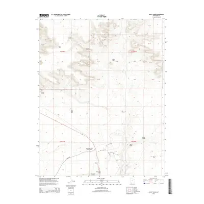
2014 Map of White Tower
USGS Topo · Published 2014About this map
White Tower and Dianas Throne stand as prominent landmarks in this high-desert landscape of Kane County, where the topography is defined by dramatic elevation shifts and deep erosional cuts. The northern portion of the map is dominated by the White Cliffs and Elkheart Cliffs, providing a vertical backdrop to the Glendale Bench and the winding course of Kanab Cr. These geologic features represent the varied terrain of the region's sedimentary layers, which are further punctuated by The Sand Hills and a complex network of drainages. To the south, the terrain descends into a series of named canyons, including Angel Canyon, West Fork Three Lakes Canyon, and Cave Lakes Canyon. The presence of Three Lakes near the intersection of Hancock Rd and Bernard Rd indicates rare localized water sources in an otherwise arid environment, while roads like Rhonda Rd and Gandolph Loop Rd suggest modern residential or recreational development within these draws.
Find a feature on this map
43 named features on this map. Tap any name to fly to it.
Don’t see what you’re looking for? This feature index may not catch every label — zoom into the map to look around manually.
Map Details
Editions of this 2014 White Tower Map
This is the sole edition of this map. No revisions or reprints were ever made.
Other maps of this area

1886 · Kanab
USGS Topo · 1:250,000

1953 · Cedar City
USGS Topo · 1:250,000

1954 · Kanab SW
USGS Topo · 1:24,000

1954 · Kanab SE
USGS Topo · 1:24,000

1954 · Johnson SW
USGS Topo · 1:24,000

1954 · Johnson
USGS Topo · 1:62,500

1957 · Kanab
USGS Topo · 1:62,500

1958 · Cedar City
USGS Topo · 1:250,000

1958 · Orderville
USGS Topo · 1:62,500

1962 · Cedar City
USGS Topo · 1:250,000