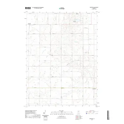
2021 Map of Whitefield
USGS Topo · Published 2021About this map
The agrarian landscape of Bureau County and Marshall County is defined by a dense network of local township roads and small rural cemeteries. The settlement of Milo serves as a central hub for the surrounding farmland, while Whitefield sits near the southeastern boundary. Genealogy researchers will find several well-preserved burial sites across the township, including Boyds Grove Cem, Milo Cem, and Hunter Cem. Water features such as Coopers Defeat Cr and Senachwine Cr carve through the agricultural blocks, alongside man-made landmarks like Newton Lake. Aviation history is present through private facilities such as the Cloverleaf Ranch Airport and the Rinkenberger RLA Airport, reflecting a post-war era of localized aerial accessibility in rural Illinois.
Find a feature on this map
63 named features on this map. Tap any name to fly to it.
Don’t see what you’re looking for? This feature index may not catch every label — zoom into the map to look around manually.
Map Details
Editions of this 2021 Whitefield Map
This is the sole edition of this map. No revisions or reprints were ever made.
Other maps of this area

1893 · Lacon
USGS Topo · 1:62,500

1893 · Hennepin
USGS Topo · 1:62,500

1909 · Hennepin
USGS Topo · 1:62,500

1911 · Hennepin
USGS Topo · 1:62,500

1921 · Buda
USGS Topo · 1:62,500

1923 · Buda
USGS Topo · 1:62,500

1933 · Lacon
USGS Topo · 1:62,500

1933 · Camp Grove
USGS Topo · 1:48,000

1937 · Lacon
USGS Topo · 1:62,500

1945 · Bradford
USGS Topo · 1:62,500