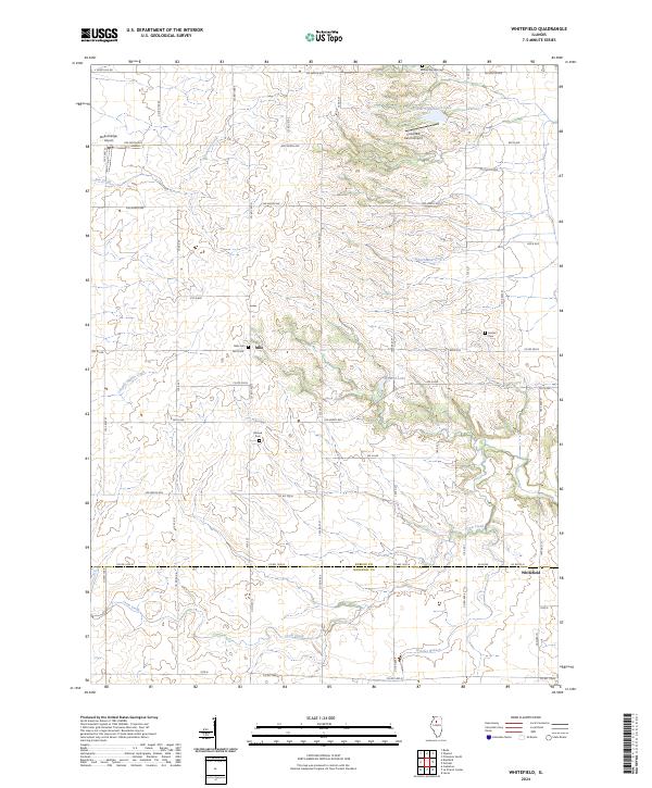
2024 Map of Whitefield
USGS Topo · Published 2024About this map
Milo and Whitefield anchor this rural landscape in Bureau County, where the transition between the agricultural uplands and the drainage basins of the Illinois River is clearly defined. The terrain is deeply incised by a series of watercourses including Senachwine Creek, Coopers Defeat Creek, and Crow Creek. This drainage network influenced the placement of local cemeteries and early roads that follow the high ground between the hollows. Genealogists and local historians can trace the distribution of early family plots and community landmarks such as Milo Cem, Mound Cem, and Hunter Cem. The presence of small airstrips like Rinkenberger Airport and Cloverleaf Ranch Airport suggests the ongoing importance of private aviation in managing these large agricultural tracts and remote homesteads.
Find a feature on this map
62 named features on this map. Tap any name to fly to it.
Don’t see what you’re looking for? This feature index may not catch every label — zoom into the map to look around manually.
Map Details
Editions of this 2024 Whitefield Map
This is the sole edition of this map. No revisions or reprints were ever made.
Other maps of this area

1893 · Lacon
USGS Topo · 1:62,500

1893 · Hennepin
USGS Topo · 1:62,500

1909 · Hennepin
USGS Topo · 1:62,500

1911 · Hennepin
USGS Topo · 1:62,500

1921 · Buda
USGS Topo · 1:62,500

1923 · Buda
USGS Topo · 1:62,500

1933 · Lacon
USGS Topo · 1:62,500

1933 · Camp Grove
USGS Topo · 1:48,000

1937 · Lacon
USGS Topo · 1:62,500

1945 · Bradford
USGS Topo · 1:62,500