
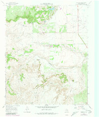
1967 Map of Whiteflat
USGS Topo · Published 1970About this map
The settlement of Whiteflat serves as the focal point for this survey of the Rolling Plains, located just north of the Middle Pease River. The landscape is defined by an extensive network of ephemeral drainages and family-named water sources, including James Jesse Draw and Deepening Spring Draw. A distinct ranching infrastructure is visible through the numerous named windmills like Stokes Windmill and Bull Cod Windmill, which were essential for sustaining livestock in this arid part of Motley County. Topographical landmarks such as Boone Mtn, Connally Peak, and Antelope Hill rise above the surrounding canyons and creek beds. The map also records early industrial imprints, featuring a prominent Pipeline crossing the northern territory and local Gravel Pits, while the Whiteflat Cem remains a significant touchstone for genealogical research in the area.
Find a feature on this map
33 named features on this map. Tap any name to fly to it.
Don’t see what you’re looking for? This feature index may not catch every label — zoom into the map to look around manually.
Map Details
Editions of this 1967 Whiteflat Map
2 editions found
Other maps of this area

1954 · Lubbock
USGS Topo · 1:250,000

1954 · Plainview
USGS Topo · 1:250,000

1958 · Plainview
USGS Topo · 1:250,000

1966 · Matador
USGS Topo · 1:24,000

1967 · Quitaque Peaks
USGS Topo · 1:24,000

1967 · Dick Moore Canyon
USGS Topo · 1:24,000

1967 · Hornica Creek
USGS Topo · 1:24,000

1967 · Flomot
USGS Topo · 1:24,000

1968 · Mac Bain
USGS Topo · 1:24,000

1968 · Roaring Springs
USGS Topo · 1:24,000