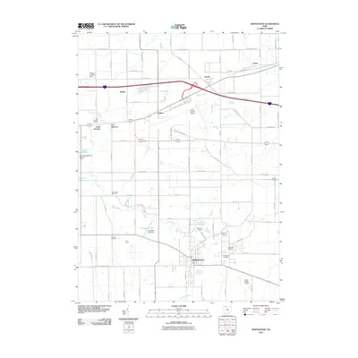
2010 Map of Whitehouse
USGS Topo · Published 2010About this map
Whitehouse serves as a primary hub in this Lucas County landscape, where the agricultural grid meets modern aviation infrastructure. The expansive grounds of Toledo Express Airport dominate the northern portion of the sheet, while smaller aviation sites like the Zeigler Landing Strip and Rocky Ridge Airpark reflect the local flight culture. Water features such as Swan Creek and Gale Run wind through the terrain, punctuated by the Swanton Reservoir and the Evergreen Lake Dam. For genealogists and local historians, the map is remarkably dense with burial sites, including the Mennonite Cemetery, Bird Family Cemetery, and Winslow Cemetery. These small family and community plots, alongside larger grounds like the Whitehouse Cemetery and Roth Cemetery, offer a clear spatial record of the area's ancestral settlement patterns and long-established homesteads between Monclova Rd and Old Airport Hwy.
Find a feature on this map
74 named features on this map. Tap any name to fly to it.
Don’t see what you’re looking for? This feature index may not catch every label — zoom into the map to look around manually.
Map Details
Editions of this 2010 Whitehouse Map
This is the sole edition of this map. No revisions or reprints were ever made.
Other maps of this area

1900 · Toledo
USGS Topo · 1:62,500

1901 · Bowling Green
USGS Topo · 1:62,500

1903 · Bowling Green
USGS Topo · 1:62,500

1909 · Mc Clure
USGS Topo · 1:62,500

1911 · Swanton
USGS Topo · 1:62,500

1914 · Swanton
USGS Topo · 1:62,500

1935 · Grand Rapids
USGS Topo · 1:24,000

1935 · Whitehouse
USGS Topo · 1:24,000

1935 · Maumee
USGS Topo · 1:24,000

1935 · Berkey
USGS Topo · 1:24,000