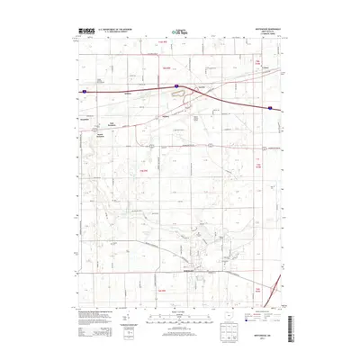
2013 Map of Whitehouse
USGS Topo · Published 2013About this map
Whitehouse anchors the southeastern corner of this Lucas County region, where the street grid transitions into the expansive agricultural and transport landscape characteristic of Northwest Ohio. The 2013 landscape is dominated by the massive infrastructure of the Toledo Express Airport and its surrounding network of shipping corridors like Cargo Pkwy E and the Old Airport Hwy. Despite this modern development, the map preserves a dense record of family and community history through its numerous burial grounds, including the Mennonite Cem, Bird Family Cem, and Winslow Cem. Natural drainage patterns like Swan Cr and Wolf Cr meander across the township lines, while the proximity of settlements like East Swanton, South Swanton, and Garden illustrates the clustering of rural residential life around historic transport routes and the Old State Line Rd.
Find a feature on this map
120 named features on this map. Tap any name to fly to it.
Don’t see what you’re looking for? This feature index may not catch every label — zoom into the map to look around manually.
Map Details
Editions of this 2013 Whitehouse Map
This is the sole edition of this map. No revisions or reprints were ever made.
Other maps of this area

1900 · Toledo
USGS Topo · 1:62,500

1901 · Bowling Green
USGS Topo · 1:62,500

1903 · Bowling Green
USGS Topo · 1:62,500

1909 · Mc Clure
USGS Topo · 1:62,500

1911 · Swanton
USGS Topo · 1:62,500

1914 · Swanton
USGS Topo · 1:62,500

1935 · Grand Rapids
USGS Topo · 1:24,000

1935 · Whitehouse
USGS Topo · 1:24,000

1935 · Maumee
USGS Topo · 1:24,000

1935 · Berkey
USGS Topo · 1:24,000