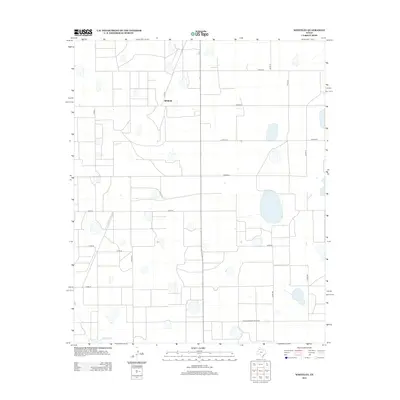
2012 Map of Whiteley
USGS Topo · Published 2012About this map
The small settlement of Whitney anchors this section of the Texas Panhandle, positioned at the intersection of a rigid grid of rural roads. The landscape is defined by the high plains topography, where numerous seasonal depressions and play lakes dot the terrain between extensive agricultural plots. In the southern reach of the survey, Quitaque Cr cuts a rare natural line through the otherwise linear property boundaries and section lines. Access through this sparsely populated region is maintained by a network of county routes, including Co Rd 11 and Co Rd 189, along with the more prominent Farm-To-Market Road 689. This 2012 record captures the area's enduring rural character, where large-scale farming and ranching are supported by a deliberate system of transport and water management in a semi-arid environment.
Find a feature on this map
18 named features on this map. Tap any name to fly to it.
Don’t see what you’re looking for? This feature index may not catch every label — zoom into the map to look around manually.
Map Details
Editions of this 2012 Whiteley Map
This is the sole edition of this map. No revisions or reprints were ever made.
Other maps of this area

1954 · Plainview
USGS Topo · 1:250,000

1958 · Plainview
USGS Topo · 1:250,000

1965 · Whiteley
USGS Topo · 1:24,000

1965 · Silverton
USGS Topo · 1:24,000

1965 · Rock Creek
USGS Topo · 1:24,000

1965 · Silverton SW
USGS Topo · 1:24,000

1966 · Sterley
USGS Topo · 1:24,000

1966 · South Plains
USGS Topo · 1:24,000

1967 · Edgemon Lake
USGS Topo · 1:24,000

1967 · Hay Lake
USGS Topo · 1:24,000