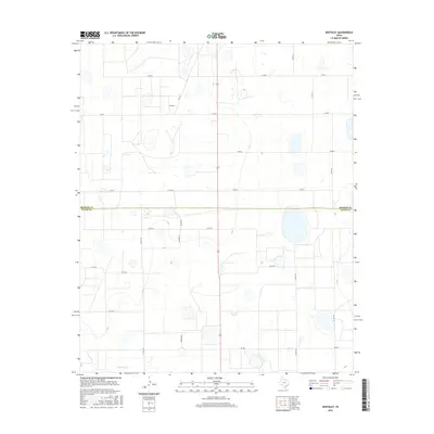
2016 Map of Whiteley
USGS Topo · Published 2016About this map
Whiteley sits at the heart of this agricultural landscape in the Texas Panhandle, positioned near the boundary of Briscoe Co and Floyd Co. The terrain is characterized by a grid of rural routes, including Co Rd C and Co Rd 11, which connect isolated farmsteads across the high plains. A prominent powerline cuts vertically through the center of the survey area, tracing a path south toward the Floyd County line near Fm 689. In the southwestern corner, the drainage of Quitaque Cr provides a subtle break in the plateau. The map captures a moment of modern rural infrastructure, where the traditional land grid is overlaid with state and county roads like Co Rd 30 and Co Rd 159, reflecting the region's enduring reliance on coordinated transport for its ranching and farming operations.
Find a feature on this map
21 named features on this map. Tap any name to fly to it.
Don’t see what you’re looking for? This feature index may not catch every label — zoom into the map to look around manually.
Map Details
Editions of this 2016 Whiteley Map
This is the sole edition of this map. No revisions or reprints were ever made.
Other maps of this area

1954 · Plainview
USGS Topo · 1:250,000

1958 · Plainview
USGS Topo · 1:250,000

1965 · Whiteley
USGS Topo · 1:24,000

1965 · Silverton
USGS Topo · 1:24,000

1965 · Rock Creek
USGS Topo · 1:24,000

1965 · Silverton SW
USGS Topo · 1:24,000

1966 · Sterley
USGS Topo · 1:24,000

1966 · South Plains
USGS Topo · 1:24,000

1967 · Edgemon Lake
USGS Topo · 1:24,000

1967 · Hay Lake
USGS Topo · 1:24,000