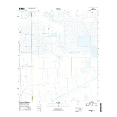
2016 Map of Whites Ranch
USGS Topo · Published 2016About this map
Sea Breeze and Whites Ranch sit within a coastal landscape defined by extensive water management and low-lying wetlands. The geography is dominated by a complex network of man-made and natural water features, including the engineered Spindletop Ditch and the industrial Intracoastal Waterway that cuts across the southern portion of the quadrangle. North of the waterway, the landscape transitions into large-scale reservoirs and marshes like Catfish Acres Reservoir and Spindletop Marsh, indicating a region heavily influenced by both cattle ranching and water conservation.
Find a feature on this map
24 named features on this map. Tap any name to fly to it.
Don’t see what you’re looking for? This feature index may not catch every label — zoom into the map to look around manually.
Map Details
Editions of this 2016 Whites Ranch Map
This is the sole edition of this map. No revisions or reprints were ever made.
Other maps of this area

1931 · High Island
USGS Topo · 1:24,000

1943 · High Island
USGS Topo · 1:31,680

1943 · Sea Breeze
USGS Topo · 1:24,000

1943 · Stowell
USGS Topo · 1:24,000

1945 · Sea Breeze
USGS Topo · 1:31,680

1950 · Houston
USGS Topo · 1:250,000

1956 · Houston
USGS Topo · 1:250,000

1961 · Star Lake
USGS Topo · 1:24,000

1961 · Mud Lake
USGS Topo · 1:24,000
1962 · High Island
USGS Topo · 1:24,000