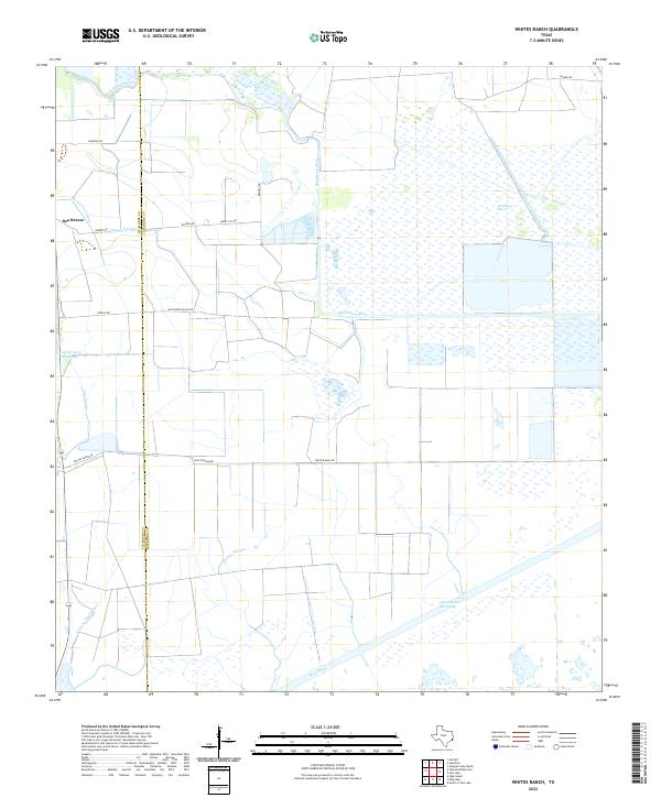
2022 Map of Whites Ranch
USGS Topo · Published 2022About this map
Sea Breeze sits near the western edge of this coastal landscape, where the flat terrain of the Texas Gulf Coast is defined by an intricate network of irrigation and drainage. The Chambers Co Jefferson Co line bisects the area, highlighting a transition between managed agricultural lands and the wilder expanses of Spindletop Marsh. Significant engineering is evident in the presence of the Devers East Canal and the massive Intracoastal Waterway to the south, which facilitate both local irrigation and industrial transit.
Find a feature on this map
23 named features on this map. Tap any name to fly to it.
Don’t see what you’re looking for? This feature index may not catch every label — zoom into the map to look around manually.
Map Details
Editions of this 2022 Whites Ranch Map
This is the sole edition of this map. No revisions or reprints were ever made.
Other maps of this area

1931 · High Island
USGS Topo · 1:24,000

1943 · High Island
USGS Topo · 1:31,680

1943 · Sea Breeze
USGS Topo · 1:24,000

1943 · Stowell
USGS Topo · 1:24,000

1945 · Sea Breeze
USGS Topo · 1:31,680

1950 · Houston
USGS Topo · 1:250,000

1956 · Houston
USGS Topo · 1:250,000

1961 · Star Lake
USGS Topo · 1:24,000

1961 · Mud Lake
USGS Topo · 1:24,000
1962 · High Island
USGS Topo · 1:24,000