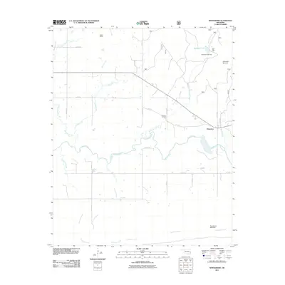
2011 Map of Whitesboro
USGS Topo · Published 2011About this map
The Kiamichi River meanders across this landscape, defining the hydrology of a region where mountain ridges and creek valleys converge. In the early 21st century, the small community of Whitesboro remains a central point of settlement, situated near the eastern edge of the quadrangle. The terrain is marked by significant elevations such as Chancellor Mountain to the east and Tombstone Mountain in the south, while Cedar Knob stands to the northwest. Water management and recreation are evident through the presence of Byhannon Lake and the Bohannon Lake Dam, which control the flow of Bohannon Creek. For those tracing local heritage, the Bohannon Cemetery and the grounds of Camp Tom Hale provide concrete points of interest within this rural Oklahoma landscape. A network of county roads, including Post Oak Rd, connects the scattered homes and varied topography of the area.
Find a feature on this map
33 named features on this map. Tap any name to fly to it.
Don’t see what you’re looking for? This feature index may not catch every label — zoom into the map to look around manually.
Map Details
Editions of this 2011 Whitesboro Map
This is the sole edition of this map. No revisions or reprints were ever made.
Other maps of this area

1900 · Winding Stair
USGS Topo · 1:125,000

1901 · Tuskahoma
USGS Topo · 1:125,000

1908 · Tuskahoma
USGS Topo · 1:125,000

1909 · Tuskahoma
USGS Topo · 1:125,000

1909 · Winding Stair
USGS Topo · 1:125,000

1940 · Red Oak
USGS Topo · 1:62,500

1943 · Red Oak
USGS Topo · 1:62,500

1950 · Mcalester
USGS Topo · 1:250,000

1962 · McAlester
USGS Topo · 1:250,000

1965 · McAlester
USGS Topo · 1:250,000