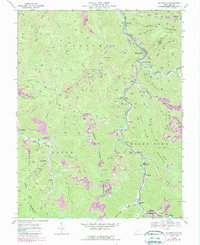
1968 Map of Whitesville
USGS Topo · Published 1989About this map
The Big Coal River and its southern fork carve through the coal-rich mountains of the Boone and Raleigh County border. This survey, updated with 1980s revisions, illustrates a landscape defined by its extractive industry, where Strip Mines and conveyor systems line the ridges of Kayford Mountain and Pond Mountain. The narrow river valleys provide the only level ground for a string of company towns and settlements, including the hub at Whitesville and the smaller communities of Montcoal, Sundial, and Stickney. Local history is preserved in small family and church plots like Asbury Cem and Mordue Cem, while the old RR grade near Garrison points to earlier eras of timber and transport. Educational centers like Marsh Fork High Sch and industrial sites like the Substation near Sundial serve as anchors for these mountain hollows.
Find a feature on this map
51 named features on this map. Tap any name to fly to it.
Don’t see what you’re looking for? This feature index may not catch every label — zoom into the map to look around manually.
Map Details
Editions of this 1968 Whitesville Map
3 editions found
Other maps of this area

1891 · Oceana
USGS Topo · 1:125,000

1891 · Raleigh
USGS Topo · 1:125,000

1893 · Oceana
USGS Topo · 1:125,000

1897 · Kanawha Falls
USGS Topo · 1:125,000

1897 · Raleigh
USGS Topo · 1:125,000

1898 · Oceana
USGS Topo · 1:125,000

1899 · Charleston
USGS Topo · 1:125,000

1900 · Kanawha Falls
USGS Topo · 1:125,000

1901 · Kanawha Falls
USGS Topo · 1:125,000

1902 · Raleigh
USGS Topo · 1:125,000