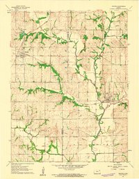
1961 Map of Whiting
USGS Topo · Published 1962About this map
Whiting and Muscotah serve as the primary rail hubs for this section of northeast Kansas in the early 1960s. The landscape is defined by the intersection of the Chicago Rock Island and Pacific and the Missouri Pacific railroads, which facilitated the movement of grain and livestock from the surrounding townships. A network of rural schools, including Walnut Sch, New Mauldin Sch, and Rose Hill Sch, suggests a community still largely oriented around small school districts before the era of widespread consolidation.
Find a feature on this map
28 named features on this map. Tap any name to fly to it.
Don’t see what you’re looking for? This feature index may not catch every label — zoom into the map to look around manually.
Map Details
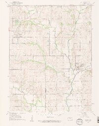
Editions of this 1961 Whiting Map
2 editions found
Other maps of this area

1885 · Atchison
USGS Topo · 1:125,000

1886 · Oskaloosa
USGS Topo · 1:125,000

1888 · Oskaloosa
USGS Topo · 1:125,000

1888 · Atchison
USGS Topo · 1:125,000

1888 · Hiawatha
USGS Topo · 1:125,000

1889 · Topeka
USGS Topo · 1:125,000

1893 · Atchison
USGS Topo · 1:125,000

1894 · Oskaloosa
USGS Topo · 1:125,000

1894 · Topeka
USGS Topo · 1:125,000

1894 · Hiawatha
USGS Topo · 1:125,000