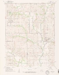
1961 Map of Whiting
USGS Topo · Published 1962About this map
The Whiting and Muscotah townships sit at a critical junction of early Kansas rail transport, where the Chicago Rock Island and Pacific and Missouri Pacific railroads trace the undulating terrain of the Kansas-Nebraska border region. This 1961 survey documents a rural landscape structured by one-room schoolhouses and small family cemeteries, including Walnut Sch and the Spring Hill Cem north of Whiting. A significant historical marker, the Old Indian Boundary, cuts across the southeastern corner of the map, signifying the legacy of earlier land treaties in Atchison and Jackson counties. The drainage of the Delaware River and its tributaries, such as Straight Creek and Little Grasshopper Creek, dictates the placement of early settlements and agricultural plots across this prairie landscape.
Find a feature on this map
27 named features on this map. Tap any name to fly to it.
Don’t see what you’re looking for? This feature index may not catch every label — zoom into the map to look around manually.
Map Details
Editions of this 1961 Whiting Map
2 editions found
Other maps of this area

1885 · Atchison
USGS Topo · 1:125,000

1886 · Oskaloosa
USGS Topo · 1:125,000

1888 · Oskaloosa
USGS Topo · 1:125,000

1888 · Atchison
USGS Topo · 1:125,000

1888 · Hiawatha
USGS Topo · 1:125,000

1889 · Topeka
USGS Topo · 1:125,000

1893 · Atchison
USGS Topo · 1:125,000

1894 · Oskaloosa
USGS Topo · 1:125,000

1894 · Topeka
USGS Topo · 1:125,000

1894 · Hiawatha
USGS Topo · 1:125,000