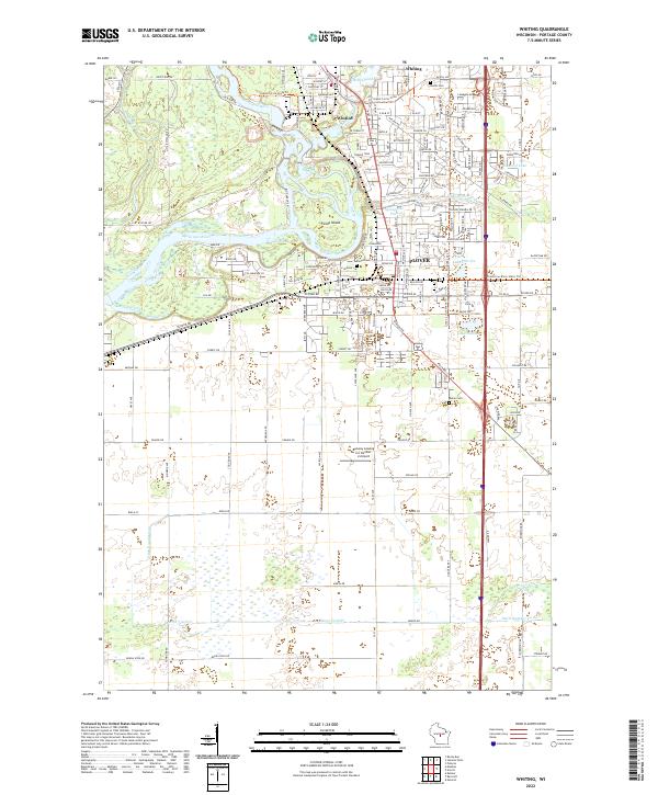
2022 Map of Whiting
USGS Topo · Published 2022About this map
The Wisconsin River and its confluence with the Plover River define the local geography of this central Wisconsin landscape, where the settlements of Whiting and Plover have developed around these vital waterways. The map illustrates a complex network of hydrologic features, including McDill Pond, Fields Island, and several man-made drainage systems like the Isherwood Lateral and Ditch Number One.
Find a feature on this map
150 named features on this map. Tap any name to fly to it.
Don’t see what you’re looking for? This feature index may not catch every label — zoom into the map to look around manually.
Map Details
Editions of this 2022 Whiting Map
This is the sole edition of this map. No revisions or reprints were ever made.
Other maps of this area

1955 · Rosholt
USGS Topo · 1:48,000

1955 · Green Bay
USGS Topo · 1:250,000

1956 · Stevens Point
USGS Topo · 1:48,000

1957 · Amherst
USGS Topo · 1:48,000

1957 · Whiting
USGS Topo · 1:48,000

1969 · Arnott
USGS Topo · 1:24,000
1969 · Almond
USGS Topo · 1:24,000
1969 · Polonia
USGS Topo · 1:24,000

1970 · Kellner
USGS Topo · 1:24,000

1970 · Stevens Point
USGS Topo · 1:24,000