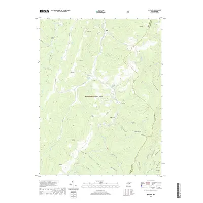
2019 Map of Whitmer
USGS Topo · Published 2019About this map
The mountain settlements of Job, Gandy, Whitmer, and Horton anchor this 2019 survey of the high-country landscape along the Randolph and Pendleton county line. Established within the Monongahela National Forest, these communities are historically tied to the timber and rail era of the Allegheny Mountains. The terrain is marked by significant elevations including Rich Mtn, Job Knob, and Spruce Mtn, with local genealogy points such as Laurel Hill Cem and the distinctively named Little Italy settlement providing windows into early upland life.
Find a feature on this map
59 named features on this map. Tap any name to fly to it.
Don’t see what you’re looking for? This feature index may not catch every label — zoom into the map to look around manually.
Map Details
Editions of this 2019 Whitmer Map
This is the sole edition of this map. No revisions or reprints were ever made.
Other maps of this area

1889 · Beverly
USGS Topo · 1:125,000

1892 · Beverly
USGS Topo · 1:125,000

1892 · Franklin
USGS Topo · 1:125,000

1896 · Franklin
USGS Topo · 1:125,000

1920 · Onego
USGS Topo · 1:62,500

1921 · Onego
USGS Topo · 1:48,000

1922 · Onego
USGS Topo · 1:62,500

1922 · Horton
USGS Topo · 1:48,000

1922 · Spruce Knob
USGS Topo · 1:48,000

1922 · Circleville
USGS Topo · 1:62,500