
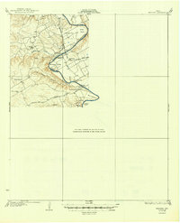
1931 Map of Whitney
USGS Topo · Published 1931About this map
The Brazos River carves a deep, winding path through Central Texas in this early 1920s survey, marking the boundary between Hill Co and Bosque Co. Before the massive reservoirs of the mid-20th century altered the landscape, the river was defined by its sharp meanders at Allen Bend, Walling Bend, and Lofers Bend. These river loops supported small agricultural communities like Nela and the McCowan Valley, where life centered around local rural schools such as Crackerbox Sch and Walling Bend Sch.
Find a feature on this map
27 named features on this map. Tap any name to fly to it.
Don’t see what you’re looking for? This feature index may not catch every label — zoom into the map to look around manually.
Map Details
Editions of this 1931 Whitney Map
2 editions found
Other maps of this area

1888 · Meridian
USGS Topo · 1:125,000

1889 · Granbury
USGS Topo · 1:125,000

1891 · Cleburne
USGS Topo · 1:125,000

1892 · Waco
USGS Topo · 1:125,000

1894 · Meridian
USGS Topo · 1:125,000

1894 · Cleburne
USGS Topo · 1:125,000

1920 · Waco
USGS Topo · 1:125,000

1924 · Waco 2-b
USGS Topo · 1:48,000

1924 · Cleburne 3-C
USGS Topo · 1:48,000

1927 · Blum
USGS Topo · 1:62,500