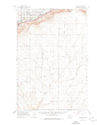
1965 Map of Whitstran
USGS Topo · Published 1976About this map
The Yakima Valley unfolds in this mid-1960s survey, illustrating a productive agricultural landscape where the Yakima River and its associated aqueducts sustain the valley floor. The northern portion of the map is dominated by the steep ascent of the Horse Heaven Hills, rising toward Chandler Butte. This area showcases the transition from irrigated riverside cultivation to high-plateau grain farming, evidenced by several Grain Elevators positioned along the expansive upland plains.
Find a feature on this map
40 named features on this map. Tap any name to fly to it.
Don’t see what you’re looking for? This feature index may not catch every label — zoom into the map to look around manually.
Map Details
Editions of this 1965 Whitstran Map
2 editions found

Other maps of this area

1906 · Blalock Island
USGS Topo · 1:125,000

1908 · Blalock Island
USGS Topo · 1:125,000

1908 · Umatilla
USGS Topo · 1:125,000

1915 · Prosser
USGS Topo · 1:125,000

1917 · Pasco
USGS Topo · 1:125,000

1917 · Prosser
USGS Topo · 1:125,000

1950 · Grandview
USGS Topo · 1:62,500

1951 · Grandview
USGS Topo · 1:62,500

1951 · Richland
USGS Topo · 1:62,500

1951 · Corral Canyon
USGS Topo · 1:62,500