2021 Map of Wickersham Draw
USGS Topo · Published 2021About this map
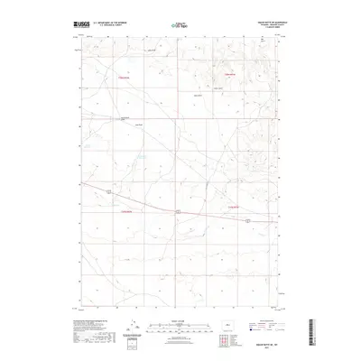
Wickersham Draw and Coal Draw intersect in a landscape defined by seasonal water management and drainage patterns in central Wyoming. This high plains environment is punctuated by man-made catchments such as Ocla Reservoir and the uniquely named Dinty Moore Reservoir, which serve as vital water sources in an otherwise arid expanse. The terrain is further etched by numerous named drainage features, including Gibbs Draw and Gates Draw to the north, and Poison Cr winding through the southern reaches. Human infrastructure is sparse, characterized primarily by the path of Jeep Pasture Rd and basic transportation routes. The map provides a detailed view of the Public Land Survey System grid, highlighting the intersections of townships T38N and T37N across ranges R92W and R91W, anchoring these ephemeral water features and land improvements to their exact legal locations.
Find a feature on this map
14 named features on this map. Tap any name to fly to it.
Don’t see what you’re looking for? This feature index may not catch every label — zoom into the map to look around manually.
Map Details
Editions of this 2021 Wickersham Draw Map
This is the sole edition of this map. No revisions or reprints were ever made.
Other maps of this area

1952 · Seventy-one Reservoir
USGS Topo · 1:24,000

1952 · Squaw Butte NE
USGS Topo · 1:24,000

1952 · Squaw Butte
USGS Topo · 1:24,000

1952 · Ocla Draw
USGS Topo · 1:24,000

1952 · Gates Butte
USGS Topo · 1:24,000

1952 · Moneta
USGS Topo · 1:24,000

1952 · Picard Ranch
USGS Topo · 1:24,000

1952 · Lysite
USGS Topo · 1:24,000

1952 · Haybarn Hill
USGS Topo · 1:24,000

1955 · Arminto
USGS Topo · 1:250,000