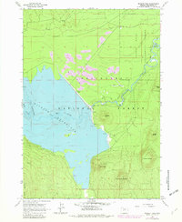
1963 Map of Wickiup Dam
USGS Topo · Published 1982About this map
Wickiup Dam and the expansive Wickiup Reservoir dominate this central Oregon landscape, a crucial water management project on the upper Deschutes River. Surveyed in the early 1960s with 1980s updates, the map highlights the managed hydrology of the Deschutes National Forest, where the reservoir's Spillway Elevation 4338 is carefully noted. This area is characterized by a series of volcanic peaks, including Wickiup Butte, Haner Butte, and Wright Butte, interspersed with meadows and forests. The mapping reflects the recreational and scientific value of the land, detailing numerous sites like Bull Bend Campground and Wyeth Campground, as well as the specialized boundaries of the Pringle Falls Experimental Forest. A network of Jeep Trails and primitive roads provides access to these timbered reaches, while the river's winding path through Dilman Meadows illustrates the transition from high-country streams to managed waterways.
Find a feature on this map
29 named features on this map. Tap any name to fly to it.
Don’t see what you’re looking for? This feature index may not catch every label — zoom into the map to look around manually.
Map Details
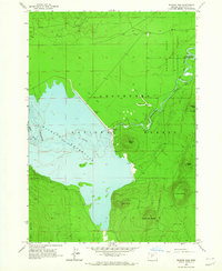
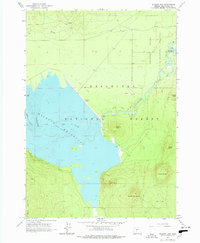
Editions of this 1963 Wickiup Dam Map
3 editions found
Other maps of this area

1930 · Maiden Peak
USGS Topo · 1:125,000

1934 · Maiden Peak
USGS Topo · 1:125,000

1955 · Crescent
USGS Topo · 1:250,000

1957 · Crescent
USGS Topo · 1:250,000

1958 · Crescent
USGS Topo · 1:250,000

1963 · Round Mountain
USGS Topo · 1:24,000

1963 · Hamner Butte
USGS Topo · 1:24,000

1963 · La Pine
USGS Topo · 1:24,000

1963 · Masten Butte
USGS Topo · 1:24,000
1963 · Pistol Butte
USGS Topo · 1:24,000