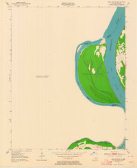
1951 Map of Wickliffe SW
USGS Topo · Published 1964About this map
The Mississippi River defines the shifting boundary between Kentucky and Missouri in this mid-century survey. Focusing on the complex fluvial environment of the river's main channel and secondary waterways, the map detail centers on a series of large river landmasses, including Islands Nos 2 3 & 4 and Wolf Island No 5. The presence of Lucas Bend and the Tennessee Slough illustrates the natural hydrology of the area before extensive modern channelization, showing how the river carved through the landscape to create features like No 4 Lake. These islands, separated by the Chute of Islands 2 3 & 4, represent a dynamic riparian borderland where the state lines of Missouri and Kentucky often follow historical water courses rather than the active main channel. For those studying the evolution of the Mississippi's path, this map provides a clear record of these islands as they existed in the early 1950s.
Find a feature on this map
13 named features on this map. Tap any name to fly to it.
Don’t see what you’re looking for? This feature index may not catch every label — zoom into the map to look around manually.
Map Details
Editions of this 1951 Wickliffe SW Map
3 editions found
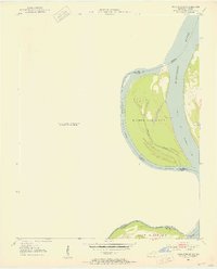
Other maps of this area

1939 · Wickliffe
USGS Topo · 1:62,500

1939 · Charleston
USGS Topo · 1:62,500

1939 · Hickman
USGS Topo · 1:62,500

1939 · Bayouville
USGS Topo · 1:62,500

1951 · Oakton
USGS Topo · 1:24,000

1951 · Wolf Island
USGS Topo · 1:24,000

1951 · Wickliffe SW
USGS Topo · 1:24,000

1951 · Arlington
USGS Topo · 1:24,000

1951 · Wickliffe
USGS Topo · 1:24,000

1952 · Wickliffe
USGS Topo · 1:62,500