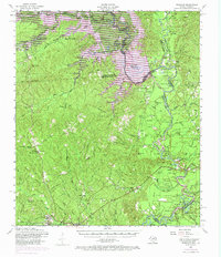
1954 Map of Wiergate
USGS Topo · Published 1970About this map
The Sabine River forms a complex, shifting boundary between Texas and Louisiana in this mid-century survey, defining the landscape through a network of sloughs and lakes. The era's massive engineering is evident in the transition to the Toledo Bend Reservoir, which altered the historical basin of the river. Inland, the Sabine National Forest covers much of the terrain, punctuated by high points like Foxhunters Hill and Hickory Ridge.
Find a feature on this map
104 named features on this map. Tap any name to fly to it.
Don’t see what you’re looking for? This feature index may not catch every label — zoom into the map to look around manually.
Map Details
Editions of this 1954 Wiergate Map

Other maps of this area

1941 · Leesville
USGS Topo · 1:62,500

1942 · Florien
USGS Topo · 1:62,500

1943 · Leesville
USGS Topo · 1:62,500

1944 · Negreet
USGS Topo · 1:62,500

1944 · Wiergate
USGS Topo · 1:62,500

1944 · Florien
USGS Topo · 1:62,500

1946 · Leesville
USGS Topo · 1:62,500

1947 · Knight
USGS Topo · 1:31,680

1948 · Leesville
USGS Topo · 1:62,500

1948 · Wiergate
USGS Topo · 1:62,500