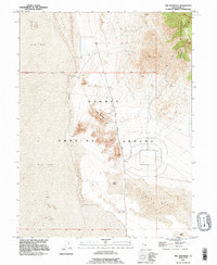
1993 Map of Wig Mountain
USGS Topo · Published 1996About this map
Dugway Proving Ground occupies much of this arid landscape in the Great Salt Lake Desert, where isolated topographic features rise sharply from the surrounding terrain. The namesake Wig Mountain serves as a prominent landmark at the center of the sheet, surrounded by extensive Sand Dunes and a sprawling Mud Flat. This 1993 revision, based on data reaching back to the mid-1950s, documents the infrastructure of this military testing range, including the North Wig Mountain Road and various 4wd tracks that provide access through the basin. Evidence of resource extraction is visible in several locations, with a Mine and Pit noted along the slopes. To the northeast, the foothills of the Cedar Mountains break the flat horizon, illustrating the stark transition from dry alkaline lake beds to mountain ridges.
Find a feature on this map
12 named features on this map. Tap any name to fly to it.
Don’t see what you’re looking for? This feature index may not catch every label — zoom into the map to look around manually.
Map Details
Editions of this 1993 Wig Mountain Map
This is the sole edition of this map. No revisions or reprints were ever made.
Other maps of this area

1885 · Tooele Valley
USGS Topo · 1:250,000

1953 · Tooele
USGS Topo · 1:250,000

1954 · Wig Mtn SW
USGS Topo · 1:24,000

1954 · Dugway Proving Ground NE
USGS Topo · 1:24,000

1954 · Camels Back Ridge NW
USGS Topo · 1:24,000

1954 · Dugway Proving Ground NW
USGS Topo · 1:24,000

1954 · Wig Mtn NW
USGS Topo · 1:24,000

1955 · Tabbys Peak
USGS Topo · 1:24,000

1955 · Wig Mtn
USGS Topo · 1:24,000

1955 · Wig Mtn NE
USGS Topo · 1:24,000