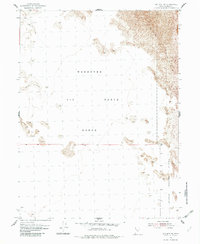
1954 Map of Wig Mtn NW
USGS Topo · Published 1982About this map
Wendover Air Force Range dominates the landscape of this 1954 topographic survey, illustrating a remote stretch of Tooele County dedicated to military operations during the mid-century. The terrain is characterized by expansive salt flats and notable clusters of Sand Dunes, with precise elevation markers tracing the subtle rises and depressions of this arid environment. The map provides a logistical connection to the southeast, noting the distance to the Dugway Proving Ground Hdqrs. 52 Mi., while the eastern edge of the sheet borders the Dugway Proving Ground. This document captures the intersection of desert geomorphology and Cold War-era defense land use, showing a region where the natural isolation of the Great Salt Lake Desert was utilized for expansive proving grounds and aerial ranges.
Find a feature on this map
5 named features on this map. Tap any name to fly to it.
Don’t see what you’re looking for? This feature index may not catch every label — zoom into the map to look around manually.
Map Details
Editions of this 1954 Wig Mtn NW Map
3 editions found
Other maps of this area

1953 · Tooele
USGS Topo · 1:250,000

1954 · Wig Mtn SW
USGS Topo · 1:24,000

1954 · Wildcat Mtn
USGS Topo · 1:24,000

1954 · Wildcat Mtn SE
USGS Topo · 1:24,000

1954 · Wig Mtn NW
USGS Topo · 1:24,000

1955 · Wig Mtn
USGS Topo · 1:24,000

1955 · Wig Mtn NE
USGS Topo · 1:24,000

1955 · Tooele
USGS Topo · 1:250,000

1973 · Knolls SE
USGS Topo · 1:24,000

1973 · Aragonite SE
USGS Topo · 1:24,000