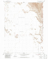
1954 Map of Wig Mtn NW
USGS Topo · Published 1986About this map
The Wendover Air Force Range dominates this mid-century topographic record of the Great Salt Lake Desert, reflecting the Cold War expansion of military testing grounds in the American West. The terrain is characterized by a stark, arid landscape where shifting Sand Dunes and low-lying salt flats meet the western edge of the Dugway Proving Ground. Based on aerial photography from 1953 and field surveys in 1954, the map reveals a wilderness virtually devoid of civilian infrastructure, emphasizing instead the vastness required for military operations. These large-scale land withdrawals were instrumental to the region's mid-century development, turning remote desert basins into restricted tactical corridors for aerospace and defense research.
Find a feature on this map
5 named features on this map. Tap any name to fly to it.
Don’t see what you’re looking for? This feature index may not catch every label — zoom into the map to look around manually.
Map Details
Editions of this 1954 Wig Mtn NW Map
3 editions found
Other maps of this area

1953 · Tooele
USGS Topo · 1:250,000

1954 · Wig Mtn SW
USGS Topo · 1:24,000

1954 · Wildcat Mtn
USGS Topo · 1:24,000

1954 · Wildcat Mtn SE
USGS Topo · 1:24,000

1954 · Wig Mtn NW
USGS Topo · 1:24,000

1955 · Wig Mtn
USGS Topo · 1:24,000

1955 · Wig Mtn NE
USGS Topo · 1:24,000

1955 · Tooele
USGS Topo · 1:250,000

1973 · Knolls SE
USGS Topo · 1:24,000

1973 · Aragonite SE
USGS Topo · 1:24,000